About the project
The website is dedicated to survival in various rural areas around the world. The site provides information on general tips for survival, as well as in various territories (for example, jungle, steppe, northern forest, mountains).
The essence and methods of orientation on the ground
Terrain orientation is a great importance in a combat filed. It is necessary, when setting combat missions for troops, to maintaine direction movement, determine the achieved lines and the location of targets in battle, as well as target designation and control of subunits and fire. In modern combat, even a temporary loss of orientation leads to disruption of command and control and interaction between subunits, jeopardizing the timely execution of a combat mission. Errors in orientation and, consequently, in determining the achieved boundaries and the position of targets on the ground can sharply reduce the effectiveness of the use of weapons and military equipment. Therefore, the ability to quickly and accurately navigate unfamiliar terrain in any environment is an important element of field training.
Terrain orientation includes setting the horizon and its location relative to surrounding objects and landforms on the terrain, as well as maintaining the intended or direction of movement. In combat conditions, during orienteering, they also determine the position on the terrain of the landmarks, their troops, the direction and depth of actions.
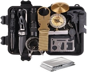
Orientation methods on the ground. You can navigate the terrain using a topographic map, aerial photographs and with the help of navigation equipment installed on combat and command-staff vehicles. The simplest methods of orientation are also widely used in a combat situation: by compass, celestial bodies and signs of local objects.
Military personnel are guided in the terrain mainly by a map using a compass. This is the main way to navigate. On terrain where there are few landmarks or significant changes have occurred, as well as in large cities, it is better to navigate by aerial photographs. Detailed images of local objects and small details that do not fit on maps allow you to quickly determine your location and accurately maintain the direction of movement. When operating at night or on a terrain with poor landmarks, movement is usually performed along azimuths prepared in advance from a map or aerial photograph. This is a fairly reliable and widely available way to navigate.
For reliable and accurate orientation in difficult terrain conditions and in poor visibility, navigation equipment is used. It allows you to know at any time the coordinates of your location on the ground and the directional angle of the direction of movement, as well as the directional angle of the direction to the final destination of the route.
The simplest ways to navigate are by compass, celestial bodies and signs of local objects are used in determining the sides of the horizon maintaining the direction of movement.
Terrain orientation can be general and detailed.
General orientation consists in an approximate determination of its location, direction of movement and the time required to reach the destination of movement. Such orientation is most often used on the march, when the crews of cars do not have maps, but use per-drawn route schemes or lists of passable settlements and other landmarks with an indication of the distances between them. On the march, in this case, it is necessary to constantly monitor the travel time, the distance traveled, which is determined by the speedometer of the car and control the passage of settlements and other landmarks according to the scheme (list).
Detailed orientationIt is included in the precise determination of its location, the position of various objects and the direction of movement. It is used when mapping the results of reconnaissance of the enemy and the terrain, determining the lines reached, target designations, movement in azimuths and in other cases.